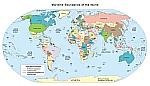
The Global Maritime Boundaries Database (GMBD) CD-ROM brings together the claims, limits and boundaries of the world with detailed attribution and documentation so they can be queried and viewed using GIS software. Included in the GMBD are: territorial seas; contiguous, joint development, fishing, and economic zones; potential claim median line solutions, disputed areas, boundary status; and much more. It will be your standard reference for quick access to vital, specific boundary information.
The Global Maritime Ports Database (GMPD) gives the location, characteristics, known facilities, and available services of nearly 5,000 ports and shipping facilities and oil terminals throughout the world. The selection of these places is based on criteria established by the National Geospatial-Intelligence Agency.
The Global Shoreline Database is a worldwide GIS database of international country land boundaries and coastlines. The data is provided in the form of ArcView shapefiles and ArcInfo coverages for six different scales. The scales are 1:250,000, 1:1,000,000, 1:3,000,000, 1:12,000,000, 1:40,000,000, and 1:120,000,000.
The Global Maritime Wrecks Database is a worldwide GIS database of over 250,000 shipwrecks. Each wreck is attributed with a variety of information.
The Global Maritime Piracy Database gives the location, dateof occurrence, type of event, victim and detailed description of piracy and anti-shipping events throughout the world. The piracy events are primarily based on the National Geospatial-Intelligence Agency reported messages of Anti-Shipping activity with additional data from supplemental sources.
The Global Maritime Warnings Database provides the location, date and type of operation of maritime activities throughout the world. Current and historical data to the mid-1980s are available. The content is primarily based on the National Geospatial-Intelligence Agency reported Broadcast Warnings to mariners.